
Martinsburg Civil War
Visitor information at 126 E Race St, or call 800-498-2386.
Belle Boyd House
126 E Race St
304-264-8801
Restored home of the famous Confederate spy and several area museums, including the Boyd Mason Civil War Museum with much on Lower Valley sites. Gift shop and Civil War information here. Open five days a week beginning in mid-April, 10 am–4 pm (closed Sunday and Wednesday). Call for winter hours. Free.
Martinsburg Roundhouse
100 E Liberty St.
304-260-4141
This site, an important repair facility on the B&O Railroad, was an attractive target for the Confederate military throughout the war. The current roundhouse dates from 1866 (it was burned during the war) but retains some of its Civil War features. It’s currently undergoing restoration. A Civil War Trails sign is located “above” the site at the end of Race Street near the Belle Boyd House.
Battle of Falling Waters
Five Trails signs describe this July 2, 1861, fight. Union soldiers marched south, crossing the Potomac River and approaching Martinsburg. Confederate Col. Thomas Jackson (later “Stonewall”) fought a delaying action just north of town. The outnumbered Confederates were forced back, but the bold demonstration kept the Federals at bay. Jackson soon slipped away, fighting again at the Battle of First Manassas later that month.
• Jackson’s Coolness Under Fire
Trails sign located at 5000 Williamsport Pike, Martinsburg 25404 (east side of road)
Sign here relates the story of a shot from a Union battery striking a tree near where Jackson was writing a message. The blast sent bark and pieces of the tree onto Jackson, which he coolly brushed aside and continued writing.
• Stuart’s Surprise
Trails sign located at 5030 Hammonds Mill Road, Hedgesville 25427
Confederate Col. J.E.B. Stuart, still dressed in his pre-war Union uniform, surprised and captured a Union infantry company nearly single handed. Stuart got the drop on the Union soldiers after boldly riding into their ranks and shouting orders. Stuart’s Confederate detachment soon came up and rounded up nearly 50 prisoners.
The three following signs are located within a short distance of 5707 Williamsport Pike, Martinsburg WV 25404:
• Four Apostles of the 1st Rockbridge Artillery
Confederate artillery, commanded by Capt. William Nelson Pendleton, unlimbered on the road here and began firing at the advancing Union infantry. The gunners named their pieces Matthew, Mark, Luke and John because “they spoke a powerful language.” These guys are on display on the VMI parade ground in Lexington VA.
• Harper’s 5th Virginia
Infantry Confederate Col. Kenton Harper deployed his infantry across the Pike here. They delayed the Union advance for a time, then withdrew. This unit, with a Revolutionary War legacy fought in blue uniforms and tri-cornered hats resembling Continental soldiers.
• Crockett-Porterfield House
Harpers 5th Virginia Infantry (see previous entry) occupied this house and farm buildings briefly and was the “key” to the units position on the battlefield. Union artillery fire directed at sharpshooters in the buildings, set fire to the barn. After Jackson withdrew, the house was used as a Union hospital.
Wheeling

West Virginia Independence Hall
1528 Market St, Wheeling WV 26003
304-238-1300.
Completed as the Wheeling Custom House at the beginning of the Civil War, this building was used for political discussions that led to West Virginia statehood in 1863. The interior of the building has been restored to its wartime appearance and the permanent exhibit “West Virginia: Born of the Civil War” uses displays and artifacts to tell the story. Open Tuesday–Saturday 9 am–5 pm. Free.
Slave Auction Block
Trails sign located across the street from Independence Hall
Wheeling was part of an antebellum buying and selling network that transferred an estimated half million slaves from Virginia to the Deep South. Slaves were kept in pens near here before being auctioned at the Market House that once stood here. Some were able to escape from captivity here to freedom north of the Ohio River with the help of the Underground Railroad.
The Athenaeum
Trails sign located at 1704 Market St, Wheeling WV 26003
The Athenaeum, once the largest building in Wheeling, stood here. The U.S. government took over the building at the outbreak of the war, detaining Confederate sympathizers here, later imprisoning Union soldiers convicted at courts-martial.
Wheeling Hospital
Trails sign located at 105 N Main St, Wheeling WV 26003
Established as a hospital in 1850, the building became a Union military facility in 1864 serving sick and wounded Union and some Confederate soldiers, many of them coming from the Athenaeum and others from the Virginia battlefields.
Charleston and area

Walking tour with Civil War Trails signs along Kanawha Boulevard
Begins at the Craik-Patton House, 2809 Kanawha Blvd East, Charleston WV 25312
This walking tour along Kanawha Boulevard tells several Charleston-area Civil War stories including the Union attempt to catch and destroy Confederates retreating from their defeats during the July 1861 “First Campaign.” Other stories include a narrow Union escape during Jenkins’s Raid in 1862, the main Union camp that was home to two future presidents, local troops including Gen. George Patton’s grandfather, the suffering of the town during occupations and the memorials at the Capitol Complex. Another Trails sign locates antebellum homes including the Craik-Patton House.
“Littlepage Mansion”
Trails sign at 1809 Washington St West, Charleston WV 25312
In July 1861 Confederates under Gen. Henry Wise constructed fortifications on this property to confront a wing of Union Gen. George McClellan’s forces marching into the area. According to tradition, the owner of the property, Rebecca Littlepage, refused to allow Wise to use her house as headquarters, enraging the general. The house was spared as Rebecca ignored threats to remove her family and destroy the building.
“The Necessary Ingredient”
Trails sign at 4200 Malden Drive, Malden WV 25306
This was a booming salt production area before the war, employing thousands of slaves and white citizens in 52 furnaces near the river. By the time of the Civil War, new salt reserves discovered elsewhere led to the decline of the industry here. The war and floods finished it off.
Battle of Scary Creek
Interpretive sign located just south of Winfield and Teays Valley roads near Nitro (on the south bank of Scary Creek)
A Rivers to Ridges Heritage Trail sign tells the story of this early (July 17, 1861) battle for control of the Kanawha Valley, which was rich in natural resources and manpower. About 1,500 inexperienced Union soldiers clashed here with equally green Confederates led by George S. Patton (grandfather of the famed WWII general). The Confederates eventually claimed a tactical victory but soon withdrew southeast, deeper into the Valley.
Civil War in Putnam County / Hoge House
Interpretive signs located at the Hoge House, behind the Putnam County Judicial Building, 12093 Winfield Road, Winfield
Two Rivers to Ridges Heritage Trail signs tell the story of Putman County and its citizens during the war. The sites of skirmishes and battles, including the Battle of Atkeson, and skirmishes at Hurricane Bridge and Winfield are located, and stories of guerilla warfare and divided loyalties are told. The Hoge House (1838) was the home of James William Hoge, who was the county’s delegate to the 1861Virginia Secession Convention in Richmond. He voted against secession and attempted to remain neutral during the war.
Parkersburg

Fort Boreman
Historical Park Fort is located in Nemesis Park, overlooking the confluence of the Ohio and Little Kanawha Rivers, off US. 50l, Marrtown Road Exit in Parkersburg
Constructed in 1863 to protect the B&O Railroad, the fort was occupied by several artillery units during the war. Its guns were fired only for visiting dignitaries and special occasions. The fort was destroyed after the war. Fort Boreman Historical Park features trails and reconstructed Civil War fortifications, interpreted trails and spectacular views. Trails sign.
“Creating West Virginia”
Trails sign located at the Oil & Gas Museum, 119 Third St, Parkersburg WV 26101
Parkersburg was a political hotbed soon after war broke out. Several prominent citizens assumed important roles in fighting for, and establishing, West Virginia statehood. Parkersburg resident Arthur Boremen became the new state’s first governor.
Vital Transportation Center
Trails sign located in Point Park, 1 Second St, Parkersburg WV 26101
Rivers, roads and railroads made Parkersburg an important transportation center and an early target of Union occupation. Seeing Confederate threats to the railroad, vital to Union interests, Gen. George McClellan occupied the town May 27, 1861. The general himself arrived in June and soon embarked on his successful campaign, winning victories at Rich Mountain and Corrick’s Ford.
Huntington and area

Battle of Guyandotte
Three Trails signs at 234 Guyan St, Huntington WV 25702
Trails signs here tell the story of the Nov. 10, 1861, battle. About 1,200 Confederate cavalrymen attacked about 150 Union recruits here on a peaceful Sunday. In the confused street fighting, several Union recruits and Confederates were killed and wounded and the rest of the Federal recruits were captured. The next day a Federal steamboat with Union reinforcements arrived and threatened to burn the town. One survivor of this episode is the Madie Carroll House.
“Albert G. Jenkins”
Trails sign at 8814 Ohio River Road, Lesage WV 25537
This is the childhood home of Albert Gallatin Jenkins, who later became the Confederate general who launched a famous raid through western Virginia in 1862, briefly crossing the Ohio River, planting a Confederate flag in Northern territory. He continued his service in West Virginia and western Virginia, dying of wounds suffered at Cloyd’s Mountain in May 1864.
Harrisville and area
Harrisville/Confederate Raid
Trails sign at the Ritchie County Historical Museum, 217 W Main St, Harrisville WV 26362
Confederate raiders under Gen. William “Grumble” Jones attacked and scattered the local home guard here May 6, 1863. The fast-moving raiders, part of the “Jones-Imboden Raid,” damaged many buildings and wrecked the U.S. Post Office in town, then moved on to destroy B&O Railroad facilities in the area.
Camp Connell
Trails sign at Ciscoe Store, Route 1, Box 66, Petroleum WV 26161
Some of the Union troops streaming into the area in the spring of 1861 camped here. These men were part of the effort to secure Western Virginia and protect the B&O Railroad and turnpikes.
Beverly and Area

Jones-Imboden Raid
Three Trails signs at the Beverly Heritage Center, 4 Court St, Beverly WV 26253
Beverly was the scene of the only significant fighting during the 1863 Jones-Imboden Confederate Raid. Trails signs tell the story of Imboden’s scouts encountering local sheriff Jesse Frank Phares, who, though wounded, warned the town about the advancing raiders. On April 24, 1863, about 900 Union defenders here put up a fight but were nearly cut off. The Federals set fire to supplies they could not carry and fled north. The Confederates put out the fires and reported nearly $100,000 supplies captured.
Note: Also see the “First Campaign” section for more Beverly area sites, including Rich Mountain.
Huttonsville
Trails sign at 2 Railroad St, Huttonsville WV 26273
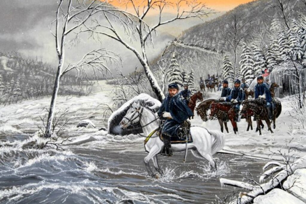
Confederate Gen. John Imboden’s 3,300 cavalry rested here April 23, 1863, preparing to attack the Federal garrison at Beverly during the 1863 Jones-Imboden Raid. Imboden’s troopers had just crossed a slush-filled Greenbrier River and marched through deep snow en route to Huttonsville.
Barboursville
Barboursville Engagement
Trails sign located at 628 Main St, Barboursville WV 25504
On July 14, 1861, a Federal column defeated a sizeable force here in the first significant action aimed at dislodging Confederates from the Lower Kanawha Valley. Three days later at Scary Creek, Union soldiers again defeated Confederates under Gen. Henry Wise, who withdrew from the Valley.
Elizabeth

Burning Springs Oil Field
Trails sign located on Route 5, approximately 5 miles east of Elizabeth
Confederates under Gen. William E. “Grumble” Jones set fire to oilfields here May 9, 1863, during the Jones-Imboden Raid. The fire turned the Little Kanawha River into a sheet of flame and could be viewed in Parkersburg. The area — the nation’s first oilfield boomtown — was strategically important and attracted much attention during the war.
Ravenswood
Ravenswood
Trails sign located at 1 Washington St, Ravenswood WV 26164
Confederate Gen. Albert G. Jenkins and his cavalrymen approached town Sept. 4, 1862, forcing a small Union force to flee across the Ohio River. Jenkins soon crossed the river himself, marched several miles into Ohio, and briefly raised Confederate flags in the state.
Williamstown
Henderson Hall
Trails sign located at 123 River Road, Williamstown WV 26187
This was the home of George Washington Henderson, a leading participant in the West Virginia statehood movement. Union soldiers often marched down the road in front of the house. Henderson’s involvement in the statehood process probably saved the home from looting.
Summersville and Area
Nancy Hart
Trails sign located at the courthouse, 700 Main St, Summersville WV 26651
The life of Nancy Hart, Confederate spy, is wreathed in legend. She spied for Confederate authorities, selling eggs and vegetables in Union camps here. Arrested in July 1862, she was detained in Summersville until staging a dramatic escape. She allegedly returned to town two weeks later, guiding Confederate raiders.
Kesslers Cross Lanes
Trails sign located at the Stop-n-Go Food Store, 5536 Summersville Lake Road, Kesslers Cross Lanes WV 26675
Confederate forces under Gen. John B. Floyd routed a Union camp here Aug 15, 1861, sending the Federals fleeing to the Kanawha Valley. Flush with victory, Floyd, instead of pursuing, withdrew to a fortified camp above Carnifex Ferry on the Gauley River. The Confederates were defeated there less than a month later.
Carnifex Ferry

Carnifex Ferry Battlefield State Park
Near Summersville, entrance 6 miles from U.S. Route 19
The Patterson House Museum is open seasonally. 304-872-0825.
Federal troops pushed Confederates from their fortifications here Sept. 10, 1861. This battle, coupled with lack of success at Cheat Mountain to the east, ended Confederate efforts to regain control of the western part of Virginia. A number of interpreted trails, some overlooking the Gauley River, are available for hikers.
Droop Mountain
Droop Mountain Battlefield State Park
15 miles south of Marlinton, entrance off Route 219
304-653-4254
Site of the last significant Civil War battle in West Virginia, Nov. 6, 1863, as Federal troops moved to disrupt the Virginia & Tennessee Railroad to the south. The Confederate defenders here eventually were overwhelmed and retreated into Virginia. A museum and trails interpret the action. Museum open seasonally.
Union Camp
Trails sign located at the Pearl Buck Birthplace, Route 219 North, Hillsboro WV 24946
Union forces under Gen. William Averell established a camp in the area Nov. 5, 1863, during a raid on the East Tennessee and Virginia Railroad. His opponent, Col. William Jackson, established defenses on the summit of nearby Droop Mountain. Averill developed his plan of attack against Jackson here, which was successful during the battle Nov. 6.
Lewisburg and Area
Battle of Lewisburg
Trails sign 215 W Washington St, Lewisburg WV 24901
Greenbrier County Visitor Center
540 N Jefferson St, Lewisburg WV USA 24901
800-833-2068
Fighting raged in this 18th-century town May 23, 1862, as Union troops moved to cut communications between Virginia and Tennessee. Annual reenactment and living history weekend held near the historic date of the battle.
Three walking tour brochures cover the town’s Civil War history and are available free at the visitor center open 9 am–5 pm Monday–Friday and 10 am–4 pm Saturday. Also open Sundays May–December noon–4 pm.
Organ Cave
Trails sign at the site located on Route 63 between Routes 219 and Route 60, south of Lewisburg
The cave was an important source of saltpeter, an essential element in the manufacture of gunpowder, making it an important resource for Confederates, who operated the mine beginning in 1861. An 1863 Federal cavalry expedition targeted the saltpeter industry in the area, but did not reach Organ Cave. Civil War-era saltpeter production equipment remains at the site. See www.organcave.org about visiting.
Buckhannon and Area

Jenkins in Buckhannon
Trails sign at 16 Marion St, Buckhannon WV 26201
Confederate Gen. Albert Jenkins overcame some Union resistance here during his late summer 1862 cavalry raid. Jenkins was attracted to the town because of vast amounts of Union supplies stockpiled here. He attacked Aug 30 and scattered men from several Union units attempting to defend the town.
Destruction at the Courthouse
Trails sign at the 38 W Main St, Buckhannon WV 26201
After defeating the town’s Union defenders Jenkins’s cavalry marched the prisoners to the courthouse and made them burn weapons and ammunition here. The building was used for storage and housing by Federal troops later in the war, causing considerable damage.
The Bassel House
Trails sign at 90 Edmiston Way, Buckhannon WV 26201
After occupying Beverly for four days, Confederate Gen. John Imboden led his wing of cavalry here to reunite with the wing under Gen. William Jones during their 1863 raid. After conferring, the Confederates moved on to Weston. Long lines of cavalry and wagons passed this spot May 2, 1863.
Kesler’s Raid
Trails sign at 88 Rock Cave Road, Rock Cave WV 26234
In September 1863, Confederate Maj. Joseph Kesler led a raid through Upshur County aimed at capturing Sutton. As Kesler made his way back to his base in Pocahontas County, he captured 70 Union militia at Centerville, which earned him praise from his commander. Hardship and death was in store for the majority of the captured, however, who were sent to Confederate prison camps.
Union
Walking Tour
Begins at the Monroe County Historical Society, 275 Main St, Union WV 24983
The following sites are all located there or nearby:
Union
This Trails sign is centrally located to Union’s many historical structures and sites including “Walnut Grove,” which was used as a hospital during Union Gen. George Crook’s occupation in 1864. Crooks troops camped in nearby fields and plundered many houses in town.
Union College
The buildings here are part of Union College, the oldest private school still standing in the state. “Sick and exhausted” Confederate soldiers stayed here in 1862, cared for by townsfolk. Two years later, Crook’s Union troops raided the school president’s house to feed the nearly 10,000 soldiers occupying the town.
Gen. John Echols House
This was the home of a local lawyer and Confederate general. Echols raised a militia company that later was incorporated into the Confederate army. He later assumed command of the entire Department of Western Virginia. He fought at Kernstown, Droop Mountain and other battles. He tried to bring his 7,000 troops to join Robert E. Lee at the end of the war, but Lee surrendered before he could get there. Echols was with Jefferson Davis during his escape attempt that ended in Georgia.
Chapman House
Father and son Chapmans, Augustus and George, served in the Confederate army. George raised his own battery from Union and fought at Droop Mountain. He was mortally wounded at the Battle of Winchester Sept. 19, 1864.
Crook’s Occupation of Union
In May 1864, following his victory at Cloyd’s Mountain, Union Gen. George Crook occupied Union with more than 10,000 men, 200 wagons and 213 prisoners. The soldiers spread out for miles, camping and foraging. While here Crook joined with Gen. William Averell after his cavalry raid in Southwest Virginia.
Romney and area

Fort Mill Ridge
2 miles west of Romney on US 50
Interpreted trail winds through this well-preserved fort commanding the Northwestern Turnpike (now Route 50). Confederates earlier used this position to defend the approaches to Romney, Union soldiers built the existing fort in 1863.
Trails signs at the following locations:
Engagement at Romney
Trails sign west of Romney on south side of Main Street (US 50). Just west of the bridge.
Learning that Confederates were occupying Romney in June 1861, Union troops under Lew Wallace (later of Monocacy fame) marched toward town. As they approached the covered bridge over the South Branch of the Potomac River, they came under fire from Sycamore Dale (across the river and upstream) and a couple of pieces of artillery. Wallace dislodged the Confederates, who fled. Wallace searched the town for weapons before returning to his base in Maryland.
Romney in the Civil War
Trails sign at 340 E Main St, Romney WV 26757
Romney’s strategic location along the turnpike connecting Winchester VA with the Ohio River and its proximity to the B&O Railroad led to numerous troop movements, battles and skirmishes during the war. The town allegedly changed hands 60 times. Caught in the middle of Northern and Southern sentiments, most of the citizens here backed the Confederacy.
Wire Bridge Engagement
Trails sign located at the south base of the Route 28 Bridge
On Oct. 24, 1861, the Union high command ordered Gen. Benjamin Kelley to strengthen his position on the B&O Railroad by taking the strategic position at Romney. Part of Kelley’s force tried to cross the river here but ran into stiff Confederate resistance and a partially destroyed bridge. This group returned to Maryland. Kelley’s other force occupied Romney until Jan. 10, 1862, when they also withdrew over this bridge to Maryland.
Stonewall Jackson Headquarters
Trails sign at 272 Main St., Romney WV 26757
Jackson made his headquarters here in the home of John B. White on Jan. 14, 1862. He planned here to pursue the Federal force that had just abandoned the town and perhaps capture Cumberland MD. Low morale, bad weather and other factors prevented Jackson to carry out his plans.
Hampshire County Courthouse
Trails sign at West Main and North High streets, Romney WV 26757
On May 23, 1861, citizens of Romney gathered here to vote on the question of Virginia’s secession. 1,188 voted for and 788 voted against. Although West Virginia became a state during the war, most residents continued to side with the Confederacy. The building suffered rough treatment during the war after being occupied by one side, then the other.
Sheetz Gun Factory
2514 Old Jersey Mountain Road, Gore WV 26757
Gunsmith Jacob Sheets found himself with more business than he could handle when, in 1861, he was busily converting old flintlock rifles found in storage in the courthouse to the more modern percussion type. This is the site of his shop and near the Confederate camps that located here to be near Sheetz and his production.
Bloomery Gap
Trails sign on Route 127, just west of the Virginia border
Confederates occupying the gap in early 1862 threatened the B&O Railroad and Union operations near the Potomac River. In mid-February a Federal force under Frederick Lander attacked the Confederate position here, scattering the troops and capturing 67. The Confederates soon reoccupied the gap.
Captain Stump
Trails sign on County Route 8 just off Main Street southwest of Romney
Hickory Grove was the home of Capt. George W. Stump, known as “Stump’s Battery” because he was always heavily armed. He rode with the Confederate McNeill’s Partisan Rangers and Gen. John Imboden during the war, finally meeting his end when he ran afoul of Union troopers in February 1865.
Berkeley Springs and area
Bath-Romney Campaign, Struggle in the Snow and Battle for Bath
Trails signs located a half block east of the intersection of Washington and Fairfax streets, Berkeley Springs WV 25411
On New Years Day 1862, Confederate Gen. Stonewall Jackson left his base in Winchester VA on a campaign to seize the county seats in Bath (now Berkeley Springs) and Romney, tear up the B&O Railroad, and perhaps advance deeper west into what was then the western part of Virginia. Jackson successfully captured Bath (Jan 4) and Romney (Jan 14), scattering Union defenders in both places. The campaign was a success, but the freezing, wet weather took its toll and created friction between Jackson and his subordinates William Loring and Richard Garnett.
A Winter Refuge
Trails sign at 110 S Washington St, Berkeley Springs WV 25411
Cold and worn out from a daylong battle Jan 4, 1862, Confederate soldiers in the “Stonewall Brigade” took refuge at the hotel and other buildings surrounding the springs. Other Confederate units didn’t fare so well. Stonewall Jackson ordered Gen. William Loring’s soldiers back on the bitterly cold march and the attack.
Skirmish at Sir John’s Run
Trails sign at 2211 Sir John’s Road, Berkeley Springs WV 25411
Union soldiers, after retreating from Bath (present-day Berkeley Springs), intended to cross the Potomac River here. After briefly holding off Confederate attacks the Federal soldiers boarded trains (this was a B&O Railroad station) and continued west to Great Cacapon, where they eventually crossed the icy river to safety.
Battle of Great Cacapon
Trails sign at 3299 Cacapon Road, Berkeley Springs WV 25411
Union soldiers established a position here protecting the B&O Railroad bridge over the Cacapon River and the ford over the Potomac. After a brief engagement, Confederate attackers withdrew and part of the Union force crossed the Potomac here in freezing weather. Confederates later entered town and burned the bridge and depot.
Camp Mud (Unger’s Crossroads)
Trails sign located at intersection of State Routes 11 and 13 (Winchester Grade Road)
Stonewall Jackson’s Confederates camped here Jan 2, 1862, on the way to Bath (Berkeley Springs) and returned here after several days of fighting and tearing up track on the B&O Railroad. The weather was horrible with snow and rain turning the fields into mud. Jackson’s men spent nearly a week here (Jan 7-13) in miserable conditions before marching to Romney.
Moorefield
Battle of Moorefield (Start)
Trails sign located at 5196 US Route 220, Old Fields WV 26845
Union troopers under Gen. William W. Averell surprised, attacked and routed Confederate cavalry under Gen. Bradley T. Johnson camped here Aug. 7, 1864.
Battle of Moorefield (Running for the Hills)
Trails sign located at 149 Hyde St, Moorefield WV 26836
Johnson’s troops were pushed back to this area where more Confederates under Gen. John McCausland were camped. The two Southern units tried to form a defensive line but they were outgunned and flanked by the Union troopers. The Confederates were forced to run for the hills. During the battle the Southern cavalry lost four cannon, 400 men and hundreds of hard-to-replace horses.
Other Moorefield Trails signs

Mathias Homestead
Trails sign located at 195 Howards Lick Road, Mathias WV 26812
After John T. Mathias enlisted in the Confederate army his family faced tough times here during the war. Both Confederate and Union troops periodically swept through here taking produce and livestock.
Wardensville
Trails sign located at 301 E Main St, Wardensville WV 26851
This busy crossroads town saw lots of action during the war. Union Gen. John C. Fremont’s 20,000 soldiers marched through here in late May 1862 on their way back to the Valley after their defeat at the hands of Stonewall Jackson there. Other units large and small found an easy route to Winchester and points south. Southern guerrillas found friends here but were warned that harboring the partisans might result in the destruction of the town.
Woodlawn
Trails sign located at 8079 State Route 259, Lost River WV 26810
The house, still standing, was the home of James W. Wood, who grew up here and was 15 years old when the war began. He joined the Confederate army in January 1864 and fought at the Wilderness, Spotsylvania and Cold Harbor. He also served with Jubal Early’s Valley army. After the war he served three terms in the West Virginia House of Delegates.
Moorefield Presbyterian Church
Sign located at 109 South Main St., Moorefield WV 26836
The leader of this church, Rev. William Wilson, and his congregation were strong Confederate sympathizers. Wilson left town in 1862 to become a chaplain in the Confederate army. During the war, both sides used the church as a hospital. Union soldiers stabled their horses inside and burned pews as firewood.
McMechen House
Trails sign 121 N Main St, Moorefield WV 26836
This circ. 1853 house served as headquarters for both sides as Moorefield changed hands several times during the war. Confederate Gen. John McCausland, was asleep here after the famous 1864 “Burning of Chambersburg” action when his troops were attacked 4 miles north of here. Union Gen. John C. Fremont used this home as his headquarters in May 1862.
Cemetery Hill
Sign located at 192 Olivet Drive, Moorefield WV 26836
Fighting erupted among the tombstones Sept. 10, 1863, when Union troops camped here were surprised by a variety of Confederate troopers. The Union position was soon overrun. The Confederates captured 160 soldiers plus wagons, horses, guns and ammunition.
Mill Island
Sign located at 710 Mill Island Road, Moorefield WV 23836
This mansion was built about 1840 for Felix Seymour and his wife. During the war the home was used as a Confederate hospital (especially for sick and wounded McNeill’s Rangers). The prosperous 1,500-acre farm suffered the loss of crops and livestock to both sides during the war.
Fremont’s Camp
Sign located at 8790 State Road 55, Moorefield WV 23836
Union Gen. John C. Fremont and his 20,000-man army arrived and camped here May 28, 1862. Fremont had been defeated by Confederate Gen. Stonewall Jackson at the Battle of McDowell earlier in the month. While here, President Abraham Lincoln urged Fremont to return to the Valley to help defeat Jackson. Rain and road conditions slowed the Federals as they broke camp here two days later to return to the Valley.
Petersburg and Area

Fort Mulligan
Interpreted trail leading to the preserved remains of the fort is accessible from the Grant Memorial Hospital Parking lot south of Route 55 in Petersburg
Constructed by Union troops in 1863 on a site formerly occupied by both sides, this strong point protected Unionists in the South Branch Valley and served as a supply depot and jumping-off points for Federal activities protecting the B&O Railroad. The fort was evacuated on Jan 31, 1864 because of an impending attack by Confederate Gen. Jubal Early. Early’s men “demolished the works” and, although military activity continued in the area, the fort was never re-occupied.
Civil War Trails sign located at 203 Virginia Ave, Petersburg WV 26847.
War in Grant County: Engagement at Johnson Run
Trails sign located at 199 S Main St, Petersburg WV 26847
Union Home Guard members clashed with a detachment of Confederate Capt. John McNeill’s Rangers near here June 19, 1864. The Home Guard, returning with supplies from the B&O Railroad, successfully defended its wagon train and withdrew.
Maple Hill Cemetery
Trails sign located 301 N Main St, Petersburg WV 26847
Union commanders ordered the protection of this cemetery while the brick church here was used as a commissary. The local congregation had stopped meeting here after Union occupation in 1862. The building was later burned and its bricks were used for flooring in winter cabins here and at Fort Mulligan.
Greenland Gap Engagement
Trails sign located in Scherr WV
A small Union detachment occupied the gap here April 25, 1863, defending it at the approach of Confederate Gen. William Jones who was en route to Rowlesburg to burn the B&O Railroad bridge there. Jones’s overwhelming numbers eventually forced the surrender of the Union force but the delay perhaps saved the Rowlesburg bridge.
Jarboe’s Blockhouse
Trails sign north of Petersburg on Route 5, south of US 48
The remnants of a blockhouse constructed by Union Capt. Ames Jarboe are nearby. The fortification was intended to guard the Morgantown and Patterson Creek Roads intersection. Jarboe’s cavalry command also guarded supply trains in the area that were the frequent target of Confederate attacks.
Rowlesburg and Area
Three Civil War Trails signs describe the action here April 26, 1863, when Confederate Gen. William E. Jones came the area aiming to destroy the B&O Railroad bridge. A determined resistance by regular Union troops and townsfolk saved the bridge. The action was part of the month-long Confederate Jones-Imboden Raid along the railroad. The 1,100-mile raid resulted in the destruction of more than 20 bridges, and the capture of more than 700 Federal troops.
B&O Railroad Bridge
Trails sign located at 37 Maple St, Rowlesburg WV 26425
If this bridge over the Cheat River were destroyed, it would disrupt critical East-West rail traffic, critical for Union war efforts in the East. An alert resident spotted Jones’s troops coming for the bridge, allowing a sturdy defense east of town. The bridge was saved.
River Road
Trails sign located south of Rowlesburg on Route 72, north of Route 50
Union troops under Maj. John Showalter, behind a barricade of logs, turned back several Confederate assaults here on this road to Rowlesburg.
Covered Bridge
Trails sign located on 7 Island Road, Aurora WV 26705
Another detachment from Jones’s raiders approached the Cheat River and the covered bridge here, hoping to approach the town from another direction. Both of Jones’s columns failed and moved on toward Fairmont.
Fairmont
Home to Francis Harrison Pierpont, governor of the Restored Government of Virginia (also known as the “Father of West Virginia”), Fairmont was attacked April 29, 1863, by Confederate forces under Gen. William Jones, part of the Jones-Imboden Raid against the B&O Railroad.
Two Civil War Trails signs highlight the Pierpont family and three describe the Raid. All are located within a couple of blocks of each other. Begin at the City Safety Building on Quincy Street. Follow the trailblazer signs to the others.
Pierpont House (site)
Francis Harrison Pierpont outlined the plan to restore loyal western Virginia counties to the Union and give life to the state of West Virginia here. The books from his library were burned in the street during the 1863 Raid.
Pierpont Graves
Pierpont and his wife, Julia, and three of their four children are buried here. The Trails sign here describes the couple’s activities during and after the war.
Jones-Imboden Raid signs

• Attack on Fairmont
Trails sign describes the scene as Confederate Gen. Jones sent two columns of men through Fairmont. Part of the raiding party attacked a suspension bridge here then headed for the nearby B&O Railroad bridge. The railroad bridge was destroyed, but quickly repaired.
• Battle for the Bridge
Detachments from several Union units stationed in Fairmont attempted to prevent Confederate raiders from crossing the suspension bridge over the Monongahela River but were ultimately overcome.
• Fleming House
This was home to Aretas Brooks Fleming, the eighth governor of West Virginia. Fleming, who was then prosecuting attorney, was with the Home Guard across the river guarding the suspension bridge. Fleming was promoted to captain in the militia for his service during the raid.
Beverly-Fairmont Turnpike
Trails sign at 100 Kirk St, Fairmont WV 26505
The main column of Confederate Gen. William Jones rode by here April 29, 1863 en route to attacking the B&O Railroad bridge, part of the objective of the 1863 Jones-Imboden Raid. This is the northern end of the Beverly-Fairmont Turnpike, a gravel road completed in 1852.
Oceana
McDonald Plantation
Trails sign located at Clearfork Valley Golf Course, 1597 Clearfork Road, Oceana WV 24870
This was the site of a 7,000-acre farm during the war, owned by William McDonald, who sided with the Confederates in this divided county. The main house was burned in 1862 during a Union raid.
“Civil War Romance”
Trails sign at 41 Agnes Lane, Oceana WV 24870
Confederate soldier Thompson Walker, in bad health and on a long road home after being released from Point Lookout (MD) prison in 1865, was nursed back to health and hidden by Martilia Walker, daughter of a staunch Unionist. A romance blossomed and they were married Dec 11, 1866.
Sutton
The town’s location on the Weston and Gauley Bridge Turnpike (one of the better roads in the area) made this town and others nearby strategically important to both armies.
Trails signs at the Sutton Courthouse, 300 Main St, Sutton WV 26601.
The War and Suttonville, (Jones-Imboden Raid)
Confederate Gen. John D. Imboden struck here May 12, 1863, part of a raid to disrupt Union activities on the B&O Railroad. Following the evacuation of the Federal garrison, the Confederates destroyed “their quarters and blockhouses” here and in nearby towns.
The Burning of Suttonville
On Dec. 29, 1861, Confederate partisans attacked Union earthworks protecting the suspension bridge across the Elk River. After the Union defenders withdrew a fire broke out (undetermined origin) that destroyed much of the town including the courthouse.
Burnsville/Napier
Battle of Bulltown
Trails sign at the Bulltown Historic Area, which is located near the Burnsville Dam and Lake. Take I-79 exit 79, then follow Route 5.
304-835-2371
On Oct. 13, 1861, Confederate forces attacked Union earthworks here, forcing the defenders to fall back through a series of fortifications. Although surrender was demanded several times, the outnumbered Union troops held out and the Confederates withdrew after a 12-hour fight. A trail leads to the earthworks defended that day. The U.S. Corps of Engineers administers the site.
Glenville
Attack on Glenville (Jenkins Raid)
Trails sign located at Glenville State College, 200 High St., Glenville WV 26351
Confederate raiders under Gen. Albert Jenkins, on a 500-mile adventure that crossed briefly into Ohio, approached Glenville Sept. 1, 1862. Union defenders here put up a fight, but Jenkins soon occupied the town.
Clarksburg and Area
Clarksburg Defenses (Jones-Imboden Raid)
Trails sign 401 High St, Clarksburg WV 26301
Union trenches here and on Pinnicinick Hill protected the North Western Virginia Railroad, a link between Grafton and Parkersburg. About 5,000 Federal troops manned these defenses, diverting a wing of Confederate attackers during the Jones-Imboden Raid in April 1863.
Bridgeport (Jones-Imboden Raid)
Trails sign 312 Railroad St., Bridgeport WV 26330
Forces under Confederate Gen. William “Grumble” Jones ran into strong defenses at Clarksburg April 30, 1863, so they did what damage they could in the area, including attacking Bridgeport. The raiders captured 47 Federal soldiers here, burned a railroad bridge and tore up track before moving on to Philippi.
Union Meetings
Trails sign 300 block West Main Street, Clarksburg WV 26301
A strong pro-Union feeling here led to early meetings and a revolt against Virginia’s secession in April 1861. Clarksburg’s citizens met in April 1861 and called for a conference that became the First Wheeling Convention in May. That meeting set the stage for West Virginia statehood.
Jackson Birthplace
Trails sign 400 W Main St., Clarksburg WV 26301
The house where Thomas J. Jackson, later “Stonewall,” was born stood across the street from this sign location. The site itself is marked with a bronze plaque. Poverty marred Jackson’s childhood here, and both parents died before he reached the age of 7. After leaving here, Jackson and his sister moved in with an uncle at Jackson’s Mill, 15 miles south of here.
Northwest Academy
Trails sign 100 block North Second Street, Clarksburg WV 26301
This was the site of one of the public buildings that served as a barracks, military prison and hospital during the Union occupation of Clarksburg. The Trails sign here describes how different Federal soldiers viewed the town, one thinking it beautiful, the other calling it a “motley collection of rickety frame houses….”
Railroad Depot
Trails sign 400 E Pike St, Clarksburg, WV 26301
This site was an important transportation hub during the war. The North Western Virginia Railroad (depot was nearby) and several turnpikes connected the town with all parts of the area. Three different Union army headquarters were established here during the war, one headed up in 1861 by Gen. George McClellan.
Arnoldsburg

Engagement at Arnoldsburg
Trails sign at intersection of Routes 33 and 119, Arnoldsburg WV 25234
Both sides recruited successfully here, revealing the area’s divided loyalties. In May 1862 a local group, the Confederate Moccasin Rangers, attacked a Union outpost here. After a four-hour fight the Confederates retreated. After this, Confederate activity in the area subsided.
Gauley Bridge
Battles for the Bridges: Gauley Bridge
Trails sign at 370 Route 60, Gauley Bridge WV 25085
The wooden covered bridge here was considered important to both sides because it helped link the Ohio and James rivers via the James River and Kanawha Turnpike. Confederate Gen. Henry Wise ordered the bridge burned while retreating from Union troops in the summer of 1861. Union forces replaced the bridge in 1862 and they used it to continue their campaign to occupy the area. The Confederates returned briefly late in the year and burned the bridge again but they soon abandoned the Valley for good.
Fayetteville
Trails signs located at 310 N Court St, Fayetteville WV 25840
Battle of Fayetteville
Confederate Gen. William Loring attacked Union forces in Fayetteville Sept. 10, 1862, hoping to gain control of this area of the important Kanawha River Valley. Stubborn Union defenders (part of whom occupied Fort Scammon on the hill) finally withdrew all the way to Ohio. The Confederates maintained control here until mid-October.
First Indirect Artillery Fire
This was the site of Fort Beauford, targeted during the 1863 Confederate “Jones-Imboden Raid.” As part of the Confederate force, including artillery, approached the fort on May 19, Confederate guns were forced to move to a more protected location out of sight of the Union position with woods intervening. The Confederates sent an observer forward to help direct the Southern guns firing on the fort, inventing the concept of “indirect fire,” shelling a site not visible to the gunner. The Federals here later chased the Confederates away with small losses.
Ansted
The following Civil War Trails signs are located within a block of 123 James River & Kanawha Turnpike, Ansted WV 25812
Tyree Tavern / Halfway House
This building, believed to be the oldest structure standing in the county, served as headquarters for both sides including the commands of Confederate Gen. John B. Floyd and the “Chicago Gray Dragoons.”
Westlake Cemetery
This is the burial site for Confederate Gen. Stonewall Jackson’s mother, Julia. The future general came here in 1855 hoping to find the grave. He stayed at Tyree Tavern and consulted with its owner William who attended his mother’s funeral. Jackson was never sure he found the unmarked grave.
Contentment
This was the post-war home of George Imboden, who served as the colonel of the 18th Virginia Cavalry, which became part of his brother John’s brigade. The unit served during the Gettysburg campaign, in West Virginia and in the Shenandoah Valley.
Alderson
Alderson’s Ferry
Trails sign 111 Railroad Ave., Alderson WV 24901
Both sides used the ferry here to cross the Greenbrier River during the war. The area saw occasional fighting for control of the ferry, including a bloody July 12, 1862, cavalry action. Future President, then General, Rutherford B. Hayes crossed here in May 1864 and camped in the area.
Princeton
McNutt House
Trails sign at 1522 N Walker St, Princeton WV 24740
304-487-1502
This home, built by Dr. Robert B. McNutt in 1840, is the only survivor of a fire set May 1, 1862, by retreating Confederates under Col. Walter Jenifer. Earlier, the Confederates had confronted the advance of Union Gen. John C. Fremont’s troops north of town as they moved to confront Gen. Stonewall Jackson’s army in the Shenandoah Valley. Fremont’s army occupied the nearly destroyed town after the fighting. Lt. Col. Rutherford B. Hayes, the future president, used this house as headquarters. House open for tours 9 am–4 pm Monday–Friday.
More Sites
Capturing Spencer
Trails sign at the Roane County Courthouse, 200 Main St, Spencer WV 25276
Confederate Gen. Albert Jenkins led 550 cavalrymen on a 500-mile raid Aug 22–Sept 12, 1862, attacking Federal forces and destroying supplies. The raiders crossed the Ohio River Sept 4 and raised the Confederate flag on Northern soil. Jenkins and his Confederates captured Spencer and a group of Union soldiers and weapons without firing a shot Sept. 1, 1862. However, the Union commander who surrendered, Col. John Rathbone, did come under fire from his superiors for his action.
The Trans-Allegheny Lunatic Asylum
71 Asylum Ave, Weston WV 26452
This facility was under construction as the war broke out and became the subject of a monetary tug-of-war. In April 1861, just before the Battle of Falling Waters, the Virginia Confederate government in Richmond called for the money appropriated for the construction to be returned to help with the war effort. Before that could happen Union soldiers occupied the town and confiscated the money in the banks. The money was moved to Wheeling and later used to help establish the new state of West Virginia. The hospital was open to patients during the war.
Last Union Raid
Trails sign at the German Valley Overlook off Route 33
On Jan. 13, 1865, Union raiders under Major Elias Troxel approached Franklin, looking for Confederate soldiers and artillery here. He found the place empty, however, because two local women had walked over North Mountain and through the snow to warn the Confederate garrison.
“McCoy House”
101 S Main St, Franklin WV 26807
Following the Battle of McDowell (VA) May 8, 1862, defeated Union forces fled to Fairmont, setting woods on fire as they retreated. This house became headquarters for Union Gen. Robert Schenck, preparing for a Confederate attack. Following some skirmishing, Confederate commander Gen. Stonewall Jackson marched away, back to the Shenandoah Valley.
Morgantown
Westover Bridge
Trails sign in Hazel Ruby McQuain Park, 100 Kirk St, Morgantown WV 26505
On April 27, 1863, Confederate Gen. William Jones occupied Unionist Morgantown during the Jones-Imboden Raid. Warned of Jones’s advance, locals hid valuables and livestock. The raiders seized what was left, returning the next day for more.